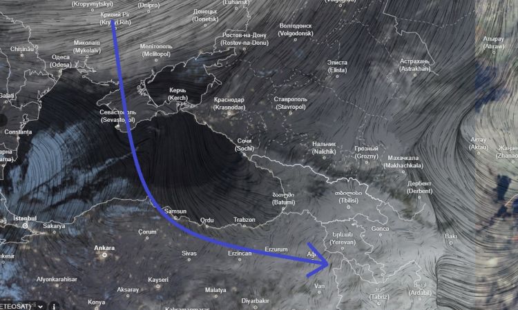
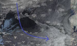
Gagik Surenyan, Deputy Director of the Hydrometeorology and Monitoring Center of Armenia, shared a satellite image showing a cyclone located to the northwest of the country and moving closer to the region. The image highlights the current weather system approaching Armenia, based on available meteorological observations.
According to Surenyan, the photograph was taken from satellite monitoring data and reflects the structure of the cyclone and its current position in relation to Armenia. At this stage, the post focuses on visual documentation of the weather system rather than forecasting specific outcomes.
The presence of the cyclone on satellite imagery indicates active atmospheric processes in the surrounding area. For official weather forecasts, temperature changes, or precipitation expectations, residents are encouraged to follow updates from the Hydrometeorology and Monitoring Center or other authorized meteorological services.
Surenyan noted the image with the caption:
“The cyclone approaching us from the northwest captured on satellite imagery.”
This post is part of ongoing weather observation efforts aimed at informing the public about significant meteorological developments in the region.
Optional Disclaimer — This information is shared for public awareness and meteorological interest. It is not a forecast or prediction. For confirmed weather updates, consult official agencies and professional forecasts.